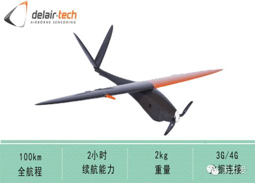

Figure 1 DT-18

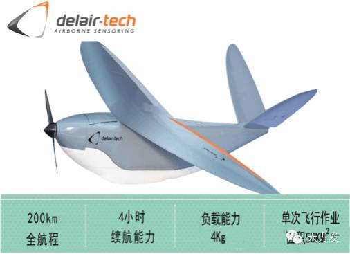
Figure 2 DT-26X
3. Advantages of DT series UAVs in geological disaster emergency and monitoring
1. Fast response capability:
Modular design, the wing can be detached, can be carried by a backpack or loaded into a portable transport box at any time, small size and light weight; take off within 5 minutes after the scene; take off with a hand throw or a catapult take off The requirements for the venue are extremely low. Abdominal landing or parachute landing, if required, can also fly to the special area of ​​the network drop or other special operations.
2. Stronger weather adaptability:
Because it can fly at low altitudes, it can fly under the cloud to obtain data, which requires less visibility. And the wind resistance is up to 8 winds.
3. Good safety performance:
Waterproof and dustproof grade IP-54 grade; complete autopilot, navigation and safety systems are approved by the Civil Aviation Administration. A step-by-step upgrade of the security system ensures system stability.
4. High-efficiency operation capacity The maximum load can reach 4KG, the longest flight time is 4 hours, the longest operation range can reach 200km, the maximum working area of ​​single frame can reach 50 km2, and the maximum video transmission radius is 20 km.
5, optional multiple sensor types

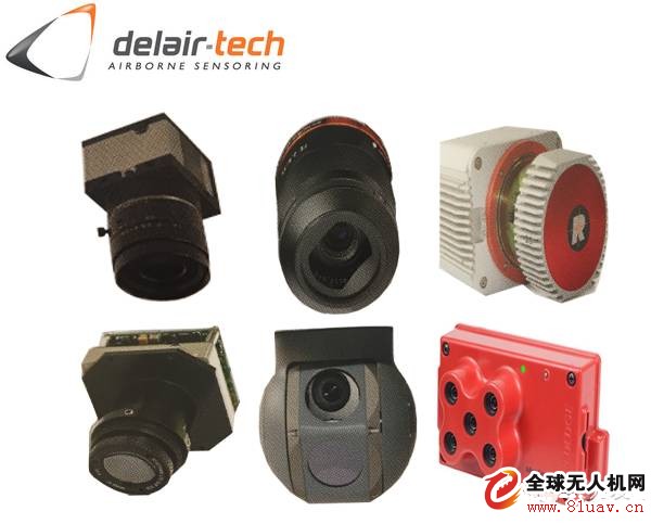
Figure 3 sensor
DT-3bands XL (RGB, DT18 optional);
DT-3bands XL (RGB, DT26 optional);
DT-5Bands (multispectral [red, green, blue, red and near infrared] DT18, DT26 optional);
DT-EYE (monitoring camera, DT18 optional);
DT-EYE XL (monitoring camera, DT26 optional);
Lidar sensor (optional for DT26).
6, the product is rich and fully functional with the standard post-processing software PIX4D high-precision mode processing can be to high-precision DOM, DSM, DEM, contour lines, point cloud 3D model products with geographic coordinates.

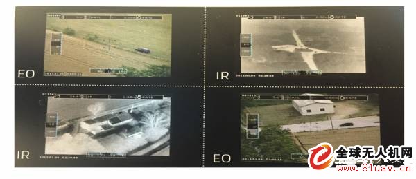
Solapp flight control software can achieve real-time image stitching. That is to say, when the aircraft is working, the control software can make a picture and a picture to be spliced, which improves the work efficiency and can provide emergency geological disaster relief. Instant messaging. With different antennas and real-time video transmission.

7. High precision The customer can choose RTK (PPK) with higher precision and high precision IMU to make the angle of the photo taken very accurate. The GNSS L1/L2 dual-band receiver provides very high GPS position accuracy with positional accuracy up to 2cm and angular accuracy of 0.025 degrees. High-precision mapping results can be obtained without placing a GCP. The sensor's ground resolution is up to 1.1cm. These superior features make measurement-level accuracy mapping projects simple, safe and fast.
VCM Spacer is a kind of metal etching spring sheets and is an important part of the VCM. VCM is include of Shield Case, Frame, F.Spacer, F.Spring, Yoke, Magnet, Coil, Carrier, B.Spacer, B.Spring, Base.
VCM is a camera important component, its main function is to allow the position of the lens to be adjusted to give a clear image. It is mainly used in camera micro zoom motor (VCM) for mobile phone camera, security camera, UAV camera, tablet computer camera, computer camera, as well as smart wear, high-end electronics, electronic scanning payment equipment and photo electricity and other fields. The material we usually use for metal etching VCM spacer are SUS304.C7701.BF158-TM10.C1990-GSH. We use fine metal etching process, and we can guarantee that our etched products have high precision, uniform etching lines, no burr surface, no notch and no deformation. We are the best supplier and manufacturer of VCM spacer in China, our VCM spacer have high quality but low price. We custom precision VCM spacer with drawings provided by customers.
VCM Spacer for Camera, Metal Etching VCM Spacer, High Precision VCM Spacer, Custom Precision VCM Spacer
SHAOXING HUALI ELECTRONICS CO., LTD. , https://www.cnsxhuali.com